Atlas D 576-A Missile Silo Vandenberg AFB California
Atlas D 576-A
Date Activated: January 26th 1960
Date Deactivated: August 5th 1965
Air Force Base: Vandenberg
State: California
Coordinates:
Latitude: 34°46'41.71"N
Longitude: 120°36'1.22"W
Decimal:
Latitude: 34.778253
Longitude: -120.600339
GPS:
Latitude: 34 46.6951666666667
Longitude: -120 36.0203333333333
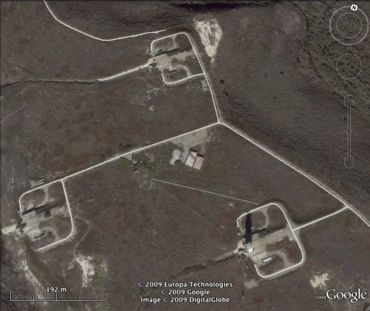
There are three sites here. Site 1 was in service October 26 1962 to November 4th 1963, then was used for the space program from May 25th 1965 to September 8th 1974. Site 2 was in active service from October 26th 1962 to August 5th 1965 then used for the space program from April 6th 1968 to September 8th 1974. This was the site of the first Vandenberg ICBM launch. Site 3 was in service from January 26th 1960 to an unknown date when it was converted to commercial use.
List of all Atlas D site Coordinates